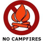
Outdoor recreationists are advised that fire restrictions have gone into effect on most federal and state lands throughout Arizona due to extremely dry conditions and high risk of wildfires. These are the restrictions that are in effect as of May 18, 2012.
So no matter where you are recreating outdoors, be extremely careful out there.
National forests
Campfire and smoking restrictions are now in effect for all national forests in Arizona (Apache-Sitgreaves, Coconino, Coronado, Kaibab, Prescott, Tonto). The restrictions prohibit campfires or the use of charcoal or wood grills and stoves, except where allowed in certain developed campgrounds or recreation sites (check the website of the individual forest you are planning to visit for updates). The restrictions also prohibit smoking except within enclosed vehicles, buildings or developed campgrounds or recreation sites.
The restrictions in some national forests also prohibit operating internal combustion power tools, using welding equipment or torches with open flames, operating combustion engines without spark-arresting devices in effective working order, or discharging firearms (i.e., target shooting) except in taking game in accordance with Arizona hunting laws in hunting season. Check with the individual forest on their particular restrictions. Please note that use of fireworks is not allowed on national forest lands at any time.
Currently, all national forest lands are open except for these closures:
The Prescott National Forest has issued a closure order for all lands south of County Road 177 due to the Gladiator Fire. All roads leading into the community of Crown King are closed. This includes Crown King Road (County Road 59), closed at Cleator; Senator Highway (County Road 52) closed at Goodwin; Forest Road 192; and Forest Road 711 (closed at the southern boundary of the Prescott National Forest). For more information, visit http://www.fs.usda.gov/prescott.
The Tonto National Forest has closed some areas relating to the Bull Flat Fire. The closure boundary starts at the intersection of Forest Road (FR) 512 and FR 33 and follows FR 512 south to its intersection with FR 358, then following FR 358 east to its intersection with the forest boundary. The boundary then follows the forest boundary north and turns directly east to the intersection of FR 34 and FR 188, then follows FR 34 north to its intersection with FR 33 and follows FR 33 west to its intersection with FR 512. FR 512 and FR 33 will remain open for travel during this closure. For more information, visitwww.publiclands.org/firenews/pressreleases/AZ.php?id=EFFZkZyEpZNzKsjpTP.
Bureau of Land Management lands
Campfire and smoking restrictions are also now in effect for Bureau of Land Management lands within the BLM Yuma, Lake Havasu, Gila, Tucson/Safford field office jurisdictions, as well as the Phoenix District (Hassayampa and Lower Sonoran field offices) jurisdictions. For a map of the BLM office boundaries, visit http://www.blm.gov/az/st/en.html.
In addition, the restrictions prohibit discharging a firearm (i.e., target shooting) except in taking game in accordance with Arizona hunting laws in hunting season. Use of fireworks is not allowed on BLM lands at any time.
National park lands
Campfire and smoking restrictions are in effect for the following areas administered by the National Park Service: Coronado National Memorial, Chiricahua National Monument, and Fort Bowie National Historic Site.
Arizona state lands
Campfire, smoking and fireworks restrictions have also been implemented by the Arizona State Forester for all state-owned and managed lands, including Game and Fish wildlife areas, all unincorporated state trust lands, and Arizona State Parks. State Park campgrounds will remain open; however parks will be under severe fire restrictions. Please call (602) 542-4174 regarding fire restrictions in all 27 state parks, or go to www.AzStateParks.gov for more information.
The restrictions also apply statewide to all Arizona Department of Transportation right-of-way property in unincorporated areas which is not federally owned. The state restrictions do not apply to private lands.
Counties
Some counties have implemented fire restrictions; check with the local jurisdiction you are planning to visit.
Tribal lands
To contact individual tribes about local conditions or restrictions, use the following numbers: Tohono O’odham (520-383-8276), San Carlos Apache (928-475-2326), Salt River Pima (480-850-8244), Navajo Nation (928-729-4007), Hopi (928-734-2106), Gila River Community (520-796-5900), Fort Apache (928-338-5326). Please remember, tribal lands are NOT public lands; please observe all tribal restrictions on access, photography, etc.
Fire restriction and closure information can change rapidly
Please note that fire restrictions and closure information can change quickly given the current conditions. For all of the above-mentioned areas, fire restrictions will remain in effect until officials within their respective jurisdictions determine that conditions have changed sufficiently to reduce the risk of human-caused wildfire.
Please check the websites of the appropriate jurisdictions. A website that includes a summary of Arizona fire restrictions is http://www.publiclands.org/firenews/.
Current fires
There are several fires currently burning in the state, most notably the Gladiator Fire in the Prescott National Forest near Crown King, the Sunflower Fire in the Tonto National Forest near Sunflower, and the Bull Flat Fire in a remote area on Fort Apache tribal land and Tonto National Forest land about 20 miles northwest of Cibecue. For the latest information about these fires, visit www.inciweb.org/state/3/.
photo: Arizona Game and Fish Department

 Your Privacy Choices