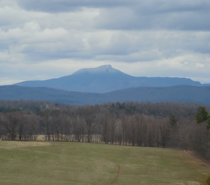
Caption: Vermont's Green Mountain Club is asking hikers to stay off high elevation trails like Camels Hump during mud season.
With spring in the air, hikers are itching to get out and hit trails.
But as the snow melts, the mud oozes.
From dirt roads to hiking trails, some pathways become rutted and muddied due to melting snow and rain.
Dirt roads can take on the personality of quick sand for some motorized vehicles, while trekkers on higher elevation hiking trails in fragile alpine terrain can cause erosion.
Given the winter that wasn’t in places like the Northeast, mud season came a good month earlier in Vermont.
The Green Mountain Club (greenmountainclub.org), stewards of the state-long Long Trail in Vermont, announced the onset of mud season March 16.
“It’s been an odd winter and we need exercise,” said GMC director of trail programs Dave Hardy in a statement. “If a trail is so muddy that you need to walk around it, please turn around and seek an alternate hike or another outdoor activity like biking or road walking.
Lower elevation trails, dirt roads and recreation paths are excellent alternatives, he suggests.
“High elevations retain snow and ice into May and hike up there is like walking inside a refrigerator so preparation is important,” he said. “We ask people to use their best judgement. The grass is greenest at the trailhead and conditions will change quickly as you ascend the mountain.”
The GMC asks hikers to say off muddy trails until Memorial Day weekend. The club stresses the trails will remain wet, muddy and prone to erosion until then.
Hikers, they say, walking on saturated soils or on sides of trails cause irreversible damage to surrounding vegetation, widen trails and inhibit natural drainage of hiking trails.
Vermont State Parks (vtstateparks.com) issued these guidelines in its blog:
- If a trail is so muddy that you need to walk on the vegetation beside it, turn back and seek another place to hike.
- Plan spring hikes in hardwood forests at lower elevations.
- Avoid spruce-fir (conifer) forest at higher elevations and on north slopes before late May and from the end of October until frozen or snow covered.
- Camels Hump and Mt Mansfield trails are closed from April 15 through the Friday of Memorial Day Weekend. Please do not hike here. Stay below 3000 feet during these times of year.
According to its blog, higher elevation soils take longer to dry out. And after winter, and heavy spring rains, the trails will take longer than normal to firm up. A trail may seem dry at the trailhead, but is muddy at a higher elevation this time of year.
Vermont State Parks offers a myriad of suggestions during mud season.
In the southern part of the state, they recommend using places like the Mt. Ascutney State Park Parkway (after mid-April), a road to the summit of the picturesque peak, and the trails in Jamaica State Park, a fine park with the winding West River piercing through it.
In the northern regions of Vermont, the Burlington Bike Path in the city along the shores of Lake Champlain is on the suggestion list as is the Missisquoi Valley Rail Trail, a nice stretch of farm, field and forest north of the state’s largest city.
The Stowe Bike Path, a 5-plus mile New England gem along the West Branch of the Little River serving up both stunning vistas of Mount Mansfield and access to restaurants and lodging opportunities.
Next door in New York with its own big Northeast peaks, the state’s Department of Environmental Conservation typically issues a request when mud season is at its worst asking high elevation hikers in the High Peaks region to stay off the trails above 3,000 feet until around mid-June.
According to Visit Adirondacks, the website of the Adirondack Regional Tourism Council, high elevation trails are wet and muddy during spring. They ask for hikers to wait until the trails are dried and hardened.
They cite the Giant, Dix and High Peaks Wilderness Areas as being particularly vulnerable and ask hikers to avoid the following:
- High Peaks Wilderness Area—all trails above 3,000 feet specifically Algonquin, Colden, Feldspar, Gothics, Indian Pass, Lake Arnold Cross-Over, Marcy, Marcy Dam-Avalanche-Lake Colden, Phelps Trail above John Brook Lodge, Range Trail, Skylight, Wright and all “trail-less” peaks.
- Dix Mountain Wilderness Area—all trails above Elk Lake and Round Pond.
- Giant Mountain Wilderness Area—all trails above Giant’s Washbowl, “the Cobbles”, and Owls Head.
Image from Arminnius on the flickr Creative Commons
 Your Privacy Choices